Toulouse Metro Map
Maps and information on lines and stations
Metro Toulouse has two main lines, Line A and Line B, which provide a comprehensive transport service within the city of Toulouse.
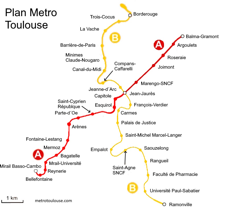
The Toulouse metro map is essential for easily navigating the city. The Toulouse subway map clearly shows stops and connections, making it easier for users to travel. To obtain a Toulouse map metro, you can consult it here or visit the official Tisséo website, where you will find downloadable versions of the metro Toulouse map .
Metro Toulouse Line A
Metro Toulouse Line A runs from the southwest to the northwest of the city, providing convenient connections to several key stations. These include Marengo-SNCF station, which also offers a direct connection to Toulouse-Matabiau Station, allowing passengers to connect to national and international destinations.
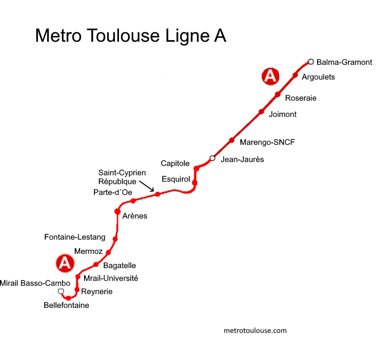
This metro line runs through important points of interest in the city, providing access to various neighbourhoods, universities and shopping areas. In addition, the stations on line A feature works of art and artistic displays that enrich the travel experience.
Line A, marked in red on the Toulouse metro map , crosses the city from east to west, connecting Balma-Gramont to Basso Cambo.
Line B of the Toulouse Metro
Metro Toulouse Line B has a different route to Line A, providing greater coverage of the metropolitan area of the city. This line connects the south and northeast of Toulouse, providing access to various residential neighbourhoods, business areas and tourist attractions.
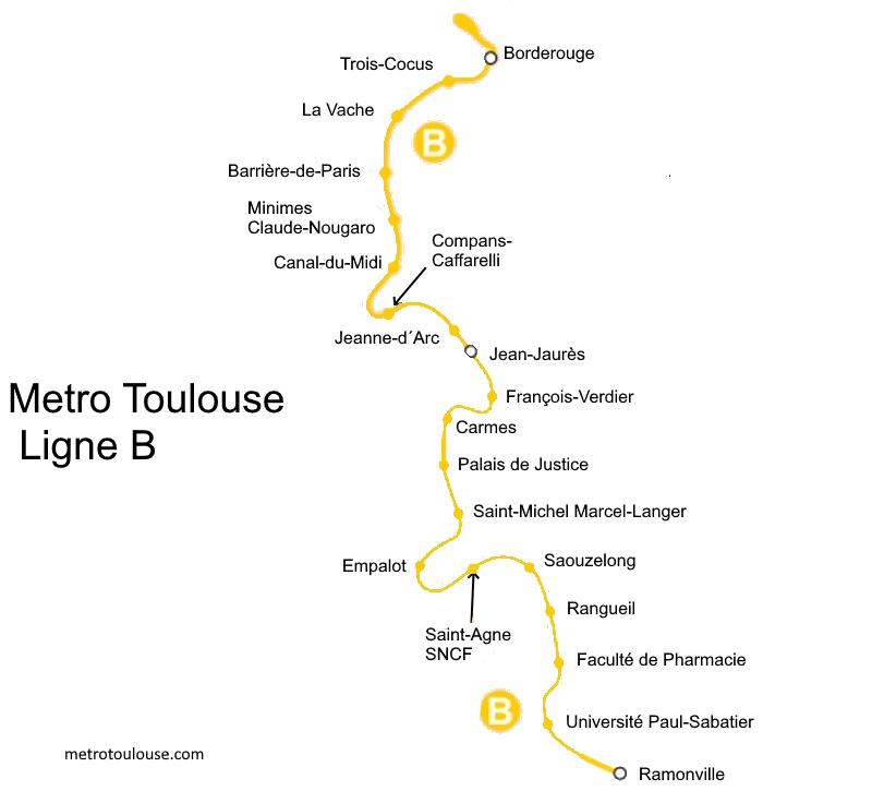
Line B, in blue, connects Borderouge in the north to Ramonville in the south. These two lines intersect at Jean Jaurès station, allowing an easy connection between them.
Like Line A, Metro Toulouse Line B features stations that showcase works of art and cultural events that enrich the environment and provide users with a unique experience during their journeys.
Metro Toulouse Plan
Metro Toulouse maps are available both at stations and online, allowing passengers to plan their routes efficiently. These detailed maps indicate the stations on each line, links to other modes of transport and the city's main points of interest.
The Toulouse metro plan is designed to be clear and understandable, even for those unfamiliar with the city, making the metro a convenient means of transportation for residents and visitors.